Find Several Birdwatching Sites Within the Rensselaer Forest Tract
The 100,000-acre Rensselaer Forest Tract is a large and mostly unfragmented forest within the Rensselaer Plateau near Grafton, Albany, and Stephentown. This Important Bird Area comprises two state parks, an environmental education center, and a Wildlife Management Area.
Bird Species You Can Expect to See
Forest breeders found here include the Ruffed grouse, Black-billed cuckoo, Yellow-bellied sapsucker, Eastern wood-pewee, Least flycatcher, Great crested flycatcher, Blue-headed vireo, Veery, Chestnut-sided warbler, Black-throated blue warbler, Black-throated green warbler, Blackburnian warbler, Blackpoll warbler, Black-and-white warbler, American redstart, Ovenbird, Canada warbler, Scarlet tanager, Rose-breasted grosbeak, Baltimore oriole, and Purple finch.
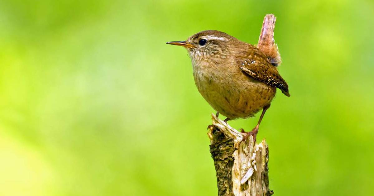
The site also supports the following species: American black duck, Pied-billed grebe, American bittern (in the cattail wetlands), Sharp-shinned hawk, Broad-winged hawk, Olive-sided flycatcher, Willow flycatcher, Common raven, Winter wren, Golden-crowned kinglet, Swainson's thrush, wood thrush, Blue-winged warbler, Prairie warbler, Cerulean warbler, and more. Thrushes use the area during migration.
The Rensselaer Plateau
The Rensselaer Forest Tract is located in the Rensselaer Plateau, which is elevated and slightly cooler and more thickly wooded than the areas surrounding the plateau. The Rensselaer Plateau Alliance works with the community to promote the conservation of the plateau's undeveloped and unfragmented forests, as they provide significant habitats for animals and plants.
The area of the plateau considered to be the forest tract stretches approximately 12 miles from Grafton Lakes State Park in the north to Cherry Plain State Park and the Capital District Wildlife Management Area in the south (the state park is part of the Wildlife Management Area). Also within the plateau is the Dyken Pond Environmental Center.
Where to Go Within the Forest Tract
Grafton Lakes State Park
Details to know: The entire park encompasses a Bird Conservation Area which supports migratory songbirds, breeding raptors, and wetland birds like the Great blue heron. Look for wetland birds along one of the many ponds or there's about 25 miles of hiking trails. The park is open year-round.
According to Friends of Grafton Lakes State Park, prime spots within the park for birding include the Mill Pond and Second Pond trails for forest birds (especially warblers), as well as the ADA portion of the Long Pond trail (the first 1/4-mile on the lefthand side of the beach to the platform), and the ADA Beaver Lodge trails. These trails are good for birding as they are relatively easy with fewer roots and rocks, so it is easy to use binoculars to look up without having to watch your feet all the time.
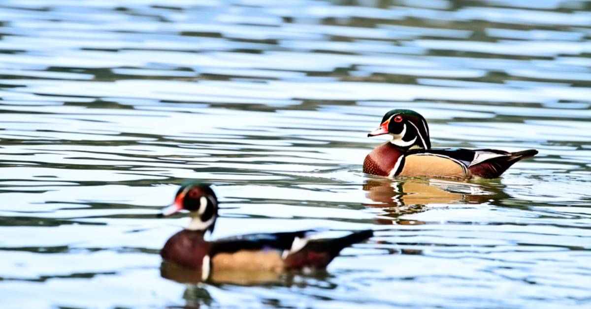
Also according to the Friends group, for observing wetland birds, birders should check out the floating platform off the Hicks Beltway Trail which is ideal for seeing Great blue herons, Wood ducks, Belted kingfishers, and Pied-billed grebes. For open areas, the Deerfield picnic area and Gartler Trails are great for seeing Kestrels, Red-tailed hawks, and the occasional Bobolink and Meadowlarks. Also, Bald eagles are found regularly on any of the larger lakes and ponds.
In addition, the Berkshire Bird Paradise is located with the park. This is a nonprofit sanctuary for disabled and injured birds. You can check out their aviary from mid-May through the end of October when they're open from 9am to 5pm each day. Admission is $8 for adults and $5 for kids.
How to get there: Coming from Albany, you'll take 787 North and get off at 9E to merge onto Route 7 East towards Troy and Bennington. Take a right onto Route 278 South, then left onto Route 2 East. The entrance can be a little confusing - as you approach and the park is on your left you take a slight right onto State Park Way which loops around into the park entrance. The fee is $8 per car, or they also accept the Empire Pass.
View a map of Grafton Lakes BCA »
See a map of the park trails »
Dyken Pond Environmental Center
Details to know: The Dyken Pond area around the center is open during daylight hours year-round and has over six miles of hiking trails. Species observed here include Black-throated blue warblers, Hermit thrushes, Black-throated green warblers, Ravens, and Barred owls. The center regularly hosts events with hiking, snowshoeing, and more.
How to get there: Take 787 North from Albany to exit 9E and merge onto Route 7 East towards Troy and Bennington. From there you'll take a right onto Route 278 South, then a left onto Route 2 East, right onto Blue Factory Hill Road, slight left onto Blue Factory Road, left onto Madonna Lake Road, and then continue straight onto Dyken Pond Road. This is a dirt road and they're at the end.
Note: While you can follow your GPS to the state parks, do not use your GPS for the Dyken Pond Environmental Center. Some GPS units direct people to the east side of Dyken Pond which is about 25 minutes from the environmental center.
View a map of the hiking trails »
See the Dyken Pond bird list »
Cherry Plain State Park
Details to know: The 175-acre park is accessible year-round and allows hiking, camping, horseback riding, cross-country skiing, and boating. The park is nearly completely surrounded by the 4,153-acre Capital District Wildlife Management Area. The primary hiking trail is the Cherry Plain State Park Loop, a six-mile trail that goes around the park and by the pond.
How to get there: Coming from Albany, you'll take 787 North to exit 5 to merge onto I-90 East towards Boston, then exit 8 for Route 43 East towards Defreestville. Continue straight onto Taborton Road from Route 43. Take a right onto Dutch Church Road, then slight right onto Miller Road. From Miller Road you can take a slight right onto State Park Road and then left onto State Camp Road and the park entrance will be on the left. The fee is $7 per car, or they also take the Empire Pass.
See the Cherry Plain State Park bird list »
Capital District Wildlife Area
Details to know: The DEC's Division of Fish and Wildlife maintains this area that is accessible year-round. There are seven miles of public truck trails with several small parking areas and pull offs throughout the road network. There's also nine miles of multi-use trails.
How to get there: The DEC provides multiple access points and links to Google Map directions on their page.
See DEC directions and info on Capital District Wildlife Area >>